Close Menu
  • English
  • Top Stories
    • News
    • Culture
    • Economy
    • Lifestyle
    • World
    • Environment
    • Health
    • Science
    • Sports
  • About Us
  • Advertising
  • Contact

Subscribe to Our Newsletter

News, investigations, and analysis — our top stories every morning to start your day right.

Illustration of the MK 15 Phalanx Close-In Weapon System on a U.S. Navy warship.
“$205 Million Through January 2029”: US Navy Awards Raytheon Massive Contract to Upgrade Autonomous Phalanx Defense Systems
Illustration of the AIRCAT Bengal MC, a 44-ton autonomous warship.
“44 Tons at 50 Knots”: US Unveils First Autonomous Warship Carrying Tomahawk Missiles Without Human Crew
Illustration of the Horus A stratospheric solar drone operating at high altitudes.
“1.5 Kilowatts of Solar Power”: US Military Drone Operates at 65,000 Feet Coordinating Switchblade Swarms From Stratosphere
Facebook X (Twitter) YouTube TikTok
Visegrád Post
Facebook X (Twitter) YouTube TikTok
newsletter
  • Featured
  • News
    Illustration of the MK 15 Phalanx Close-In Weapon System on a U.S. Navy warship.

    “$205 Million Through January 2029”: US Navy Awards Raytheon Massive Contract to Upgrade Autonomous Phalanx Defense Systems

    11/09/2025
    Illustration of the AIRCAT Bengal MC, a 44-ton autonomous warship.

    “44 Tons at 50 Knots”: US Unveils First Autonomous Warship Carrying Tomahawk Missiles Without Human Crew

    11/09/2025
    Illustration of the Jiu Tian drone carrier deploying swarms of drones.

    “100 Drones in One Carrier”: China Deploys World’s Largest Jiu Tian Mothership Capable of 4,350 Mile Kamikaze Missions

    11/09/2025
    Illustration of the U.S. F-15E Strike Eagle equipped with AGR-20F Advanced Precision Kill Weapon System.

    “Three Days Airborne”: Air Force Mounts Laser Guided Rockets on F-15E Eagles in Record Time

    10/09/2025
    Illustration of high-energy laser systems integrated on a military vehicle platform.

    These High Energy Weapons Neutralize Drone Swarms With Precision While Eliminating Collateral Damage Risks

    10/09/2025
  • Culture

    “They Weren’t Just Soldiers—They Were Giants”: Enormous Roman Shoes Found Near Hadrian’s Wall Stun Archaeologists Worldwide

    15/07/2025
    Illustration of the universal traits defining cool individuals across different cultures, as revealed by a global study, generated by artificial intelligence.

    “These Six Traits Make Anyone Instantly Cool”: Scientists Reveal the Universal Personality Blueprint Shared by Charismatic People Across Every Culture and Age

    12/07/2025
    Illustration of the rediscovery of a 1,000-year-old Babylonian hymn through artificial intelligence.

    “They Thought It Was Lost Forever”: AI Brings 1,000-Year-Old Babylonian Hymn Back to Life, Revealing Forgotten Glory in Astonishing Detail

    09/07/2025
    Illustration of a Viking woman and her loyal dog in a 1,100-year-old boat grave. Image generated by AI.

    “1,100-Year-Old Boat Grave” Unearthed: This Astonishing Discovery Reveals Loyal Dog Buried With Viking Woman, Shocking Archaeologists Worldwide in 5-Foot-Long Find

    18/06/2025
    Illustration of Boston Dynamics' Spot robots performing a dance routine on America’s Got Talent stage. Image generated by AI.

    “Robot Dogs Steal the Show”: These Dancing Machines Just Lit Up America’s Got Talent Stage With Moves That Left Judges Speechless

    16/06/2025
  • Eco
    Illustration of trade tensions between the United States and China over rare-earth magnet exports.

    Trump Warns: The US Could ‘Cripple China’ With 200% Tariff on Crucial Magnets

    29/08/2025
    Illustration of the Wangu gold field discovery beneath the hills of Hunan Province, China.

    “They Were Pulling Gold Like Roots”: Experts Staggered After Unearthing $84 Billion Deposit In One Of Earth’s Richest Soil Zones

    23/08/2025
    Illustration of robotic arms working on the assembly line of new energy vehicles at an intelligent factory in Changxing, China.

    “They’re replacing us with machines”: China’s Robot Boom Sparks Fears of Massive Job Loss as AI Factories Multiply

    14/08/2025
    Illustration of the bustling Guiwan area in Shenzhen, China, highlighting its rapid economic growth and wealth accumulation.

    “They’ve Minted 50,000 Millionaires In One City”: Shenzhen Becomes World’s Fastest-Growing Wealth Hub On Back Of Explosive Tech Industry And Investor Influx

    11/08/2025
    Illustration of the Port of Neom construction progress within Oxagon city's infrastructure.

    “Nothing on Earth Compares to This” Timelapse Captures Jaw-Dropping Scale of Mega Port Rising at World’s Largest Construction Site

    01/08/2025
  • Lifestyle
    Illustration of Huafa Ice and Snow World transforming Shenzhen into a winter sports destination.

    “They’re Making It Snow In The Tropics”: Shenzhen Builds China’s Largest Indoor Ski Resort With Year-Round Slopes And Record-Breaking Winter Attractions

    11/08/2025
    Illustration of Jeff Bezos and Lauren Sanchez's lavish wedding in Venice with a backdrop of luxury yachts and private jets. Image generated by AI.

    “Bezos Takes Over Venice”: 80 Private Jets and a Three-Day Party Spark Outrage as Billionaire Turns City Into His Wedding Playground

    01/07/2025
    Illustration of a 71-year-old Chinese grandmother competing in a fitness contest and a math prodigy launching a social media account. Image generated by AI.

    “China’s Fitness Grandma Breaks the Internet”: Math Prodigy, Viral Icons, and 3 More Stories You Won’t Believe Are Real

    22/06/2025
    Illustration of a serene Hong Kong apartment interior featuring rich timber hues and a cozy atmosphere. Image generated by AI.

    Wood Is the New Gold: Discover How This Natural Material Is Revolutionizing Hong Kong Homes with Quiet Luxury Appeal

    19/06/2025
    Illustration of using lemons as a natural cleaning agent for ovens. Image generated by AI.

    “This Oven Lemon Trick Is Pure Genius”: The Astonishing Cleaning Hack That’s Revolutionizing Kitchens and Making Everyone Want to Try It Now

    27/05/2025
  • World
    Illustration of the Eurofighter aircraft potentially adapted to carry a nuclear payload.

    “Three Years to Build a Euro-Bomb”: EU Nuclear Expert Says Europe Could Develop Independent Arsenal Using Manhattan Project Timeline

    11/09/2025
    Illustration of Ukraine's strategic military adaptations amidst evolving geopolitical dynamics.

    “1,000 Interceptor Drones Daily”: Ukraine Announces Massive Production Plan as ATACMS Stockpile Drops to Just 50 Missiles

    11/09/2025
    Illustration of Ukrainian forces targeting a Russian missile defense system in Crimea.

    “540 Drones and 45 Missiles”: Russia Launches Massive Attack on 14 Ukrainian Regions Following Crimean Strike

    10/09/2025
    Illustration of Israel's Tank Fleet in the Context of Middle Eastern Military Dynamics.

    Egypt Shocks Israel With 3,620 Battle Tanks While Tehran’s Secret Arsenal Threatens Regional Military Balance Forever

    09/09/2025
    Illustration of global military rankings and the nations shaping international power in 2025.

    “US Dominates 2025 Military Rankings”: America Leads Global Firepower Index With 0.0744 Score While Russia And China Tie For Second Place In Fierce Arms Race Competition

    08/09/2025
  • Green
    Illustration of endangered angel sharks being served in a Brazilian public institution.

    Brazil’s Schools Unknowingly Serving Extinct Angel Sharks to Millions of Children Through Devastating Legal Loophole

    09/09/2025
    Illustration of the OceanX dual-headed offshore wind turbine operating off the coast of Guangdong, China.

    “World’s First Two-Headed Wind Turbine Goes Live”: Chinese Engineers Build 16 Megawatt Ocean Monster That Powers 30,000 Homes While Surviving Category 5 Hurricane Winds

    08/09/2025
    Illustration of an Airbus A400M aircraft equipped with a water bomber conversion kit.

    “Military Planes Drop 44,000 Pounds Of Water”: Airbus Creates Revolutionary Firefighting Kit That Triples Bomber Capacity While Megafires Devastate America And Australia

    07/09/2025
    Illustration of a nuclear-powered container ship concept developed by Hyundai.

    “This Nuclear Ship Carries 15,000 Containers”: Hyundai Develops Revolutionary SMR Powered Vessel That Could Eliminate Maritime Carbon Emissions While Transforming Global Shipping Forever

    07/09/2025
    Illustration of a nuclear power plant temporarily shut down due to a swarm of jellyfish clogging its cooling system.

    “These Jellyfish Shut Down Our Nuclear Plant”: Massive Swarm Clogs French Reactor Cooling System While Climate Change Creates Unprecedented Marine Threats To Critical Infrastructure

    07/09/2025
  • Health
    Illustration of Vibrio vulnificus bacteria in Gulf Coast waters.

    “They Watched My Skin Disappear”: US Beaches Rocked by Flesh-Eating Bacteria Outbreak as Multiple Deaths Spark Nationwide Panic and Urgent Health Warnings

    08/08/2025
    Illustration of toddlers in a daycare setting exposed to hidden toxins, generated by artificial intelligence.

    “American Parents Outraged by Toxin Exposure”: New Study Reveals 90% of US Toddlers Are Ingesting Dangerous Hidden Chemicals Daily

    10/07/2025
    Illustration of effective hydration strategies during heatwaves. Image generated by AI.

    “Stop Doing This When It’s Hot”: Scientists Confirm Everyone’s Go-To Cooling Trick Actually Makes Heat Worse, Not Better

    03/07/2025
    Illustration of a medical laboratory 3D bioprinting an organ. Image generated by AI.

    “3D-Printed Cells Fight Diabetes”: Scientists Create Pancreatic Islets That Could Revolutionize Personalized Treatment Worldwide

    02/07/2025
    Illustration of Dr. Howard Tucker, a neurologist and centenarian, embodying longevity and vitality. Image generated by AI.

    “Still Practicing at 102”: World’s Oldest Doctor Reveals Daily Habits and Mindset Behind His Extraordinary Longevity and Sharpness

    01/07/2025
  • Science
    Illustration of the Horus A stratospheric solar drone operating at high altitudes.

    “1.5 Kilowatts of Solar Power”: US Military Drone Operates at 65,000 Feet Coordinating Switchblade Swarms From Stratosphere

    11/09/2025
    Illustration of a drone system reflecting high-powered laser beams to cut through metal.

    “30 Kilowatts Reflected From Ground”: Chinese Drone System Uses Laser Mirrors to Cut Through Metal Without Carrying Power Source

    11/09/2025
    Illustration of helium-enhanced missile propulsion demonstrating increased thrust and reduced infrared detectability.

    “Three Times More Thrust”: Chinese Scientists Use Helium Injection to Triple Missile Power While Reducing Heat Signatures

    11/09/2025
    Illustration of Oklo's Advanced Fuel Center in Oak Ridge, Tennessee.

    “$1.68 Billion Facility”: Tennessee Nuclear Plant Transforms 94,000 Tons of Radioactive Waste Into Gigawatts

    10/09/2025
    Illustration of the massive natural hydrogen reserve discovered in Lorraine, France.

    Scientists Uncover Shocking 46 Million Tons of Clean Hydrogen Buried Beneath France That Changes Everything

    09/09/2025
  • Sports
    Illustration of Wunderbar triumphantly crossing the finish line at Sha Tin. Image generated by AI.

    “Wunderbar Stuns Rivals”: Astounding Comeback as Racing Star Dominates 6-Furlong Class Two Victory at Sha Tin, Reigniting Fans’ Passion

    20/06/2025
    Illustration of a paraglider caught in a cloud suck ascending to a high altitude. Image generated by AI.

    “Dragged to 28,000 Feet”: Paraglider Survives Terrifying Cloud Suck Ordeal That Nearly Ended in Instant Death

    07/06/2025
  • English
Visegrád Post

“Maps Are Lying to You”: Unbelievable Truth About These Countries’ True Sizes Revealed Without Distortion—Prepare to Be Stunned by the Real World

Maps, long relied upon for navigation and education, often distort the true size of countries and continents, prompting platforms like The True Size to offer a more accurate, interactive perspective on global geography.
Eirwen WilliamsEirwen Williams23/05/202510
Share Twitter Facebook LinkedIn WhatsApp Email Copy Link
Follow Us
Google News
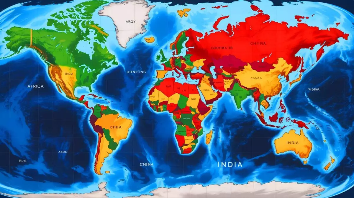
Illustration of the size comparison of countries on a world map to reveal true geographic scales. Image generated by AI.
Share
Twitter Facebook LinkedIn WhatsApp Email Copy Link
IN A NUTSHELL
  • 🌍 The True Size platform allows users to compare the actual sizes of countries, revealing common map distortions.
  • 🗺️ The Mercator projection, widely used but inaccurate, is challenged by alternatives like the Peters projection.
  • 📚 This educational tool highlights how traditional maps can distort our geographical perceptions.
  • 🔍 Users can explore and correct misconceptions about the size of continents and countries through interactive comparisons.

In our increasingly interconnected world, understanding geography is more crucial than ever. However, the maps we commonly use might not always reflect the real size of countries and continents. Various cartographic projections often distort these sizes, leading to misconceptions about the true scale of different regions. Fortunately, an interactive platform known as The True Size allows users to visualize and compare the actual sizes of countries, offering a more accurate perspective on global geography. This article explores the implications of these distortions and the solutions available to address them.

An Interactive Platform for Accurate Comparisons

Geographical knowledge extends beyond knowing country names and capitals; it encompasses understanding the actual size of these regions. Most traditional maps, especially those found in educational materials, fail to represent countries’ true sizes accurately. For instance, many perceive Russia as larger than Africa or Europe as almost equivalent in size to the United States, which is far from accurate. The True Size offers an innovative solution by allowing users to compare countries like China, the United States, and India against others globally.

When displayed on the platform, these countries fill only a small portion of the African continent, highlighting Africa’s immense size. Users can drag and drop countries across the map to see how their sizes change with different projections. This feature reveals how the selected country’s outline expands or contracts, depending on the map projection used. Moreover, the search bar enables users to explore the contours of any nation, providing an engaging way to understand global geography. For instance, when France is compared with Brazil, it occupies only a tiny fraction of the latter.

Selecting a Better Map Projection

The True Size utilizes the Mercator projection, commonly used worldwide, despite being one of the least accurate among numerous cartographic projections. Developed in 1569, the Mercator projection distorts sizes, making regions near the poles appear larger than they are. This distortion is so significant that even Google Maps abandoned it in 2018 in favor of more accurate representations. While The True Size highlights these distortions, adopting a more precise projection could provide even more realistic size comparisons.

“China’s Military Behemoth”: Satellite Images Expose This Colossal 2,500-Acre Defense Hub, Sparking Global Tension and Curiosity

The Peters projection, created in 1855, offers a less distorted view, making it one of the most intriguing alternatives. By using projections like Peters, users can access maps that better approximate real-world sizes. Beyond simple size comparisons, The True Size serves as an educational tool, raising awareness about the importance of map projections and the biases they introduce in our geographical perceptions. Many users discover for the first time that Africa is much larger than the Mercator projection suggests, challenging long-held misconceptions taught through traditional maps.

The Educational Value of Map Projections

Understanding map projections is crucial for anyone interested in geography. The distortions present in commonly used maps can significantly impact how we perceive the world. By offering an interactive platform, The True Size educates users on these distortions and provides a hands-on approach to learning about geographical scale. This educational aspect is particularly important for students, educators, and anyone interested in gaining a more accurate understanding of global geography.

Interactive tools like The True Size make learning engaging and accessible, allowing users to explore and compare different countries’ sizes easily. By visualizing these comparisons, users can grasp the true scale of continents and countries, fostering a deeper appreciation for the complexities of global geography. This understanding is essential in a world where geographical knowledge is increasingly vital for informed decision-making and global awareness.

“China Unveils Colossal Military Hub”: Satellite Images Confirm Construction of World’s Largest Base Covering 1,000 Acres

Challenging Long-Held Geographic Misconceptions

Many people grow up with misconceptions about the size of different countries and continents, primarily due to the distortions present in traditional maps. These misconceptions can influence how we perceive global dynamics and relationships between countries. Platforms like The True Size challenge these misconceptions by providing accurate size comparisons and highlighting the importance of choosing the right map projection.

By engaging with these tools, users can correct their misconceptions and develop a more nuanced understanding of the world. This shift in perception can have far-reaching implications, influencing everything from educational curricula to international relations. As more people become aware of the inaccuracies in traditional maps, there is potential for a broader shift in how we teach and understand geography.

As we continue to rely on maps for navigation, education, and understanding, it’s essential to recognize their limitations and potential for distortion. The True Size offers a valuable resource for anyone seeking a more accurate perspective on global geography. By exploring these interactive tools, we can better appreciate the true scale of our world. How might this newfound understanding of geographical accuracy influence our perception of global issues and relationships?

Our author used artificial intelligence to enhance this article.

Did you like it? 4.4/5 (30)

Subscribe to Our Newsletter

News, investigations, and analysis — our top stories every morning to start your day right.

Cartographic Distortion Geographic Education Interactive Learning
Follow on Google News Follow on X (Twitter)
Share. Twitter LinkedIn Facebook WhatsApp Email Copy Link
Previous Article“Microplastics Are a Health Time Bomb”: This Alarming Pollution Crisis Could Endanger Millions with Invisible Threats Lurking in Every Corner
Next Article “Nasa Sounds the Alarm”: Massive Earth Anomaly Linked to Mysterious Forces Deep Underground, Scientists in Frenzy Over This Unprecedented Discovery
Eirwen Williams
  • X (Twitter)

Eirwen Williams is a U.S.-based journalist at Visegrád Post, covering global news, politics, economics, science, culture, and society. Trained in a prominent journalism program in New York, she investigates the stories shaping today’s world — from international affairs and scientific advances to cultural movements and health trends. Her work brings sharp insight into the forces behind the headlines, from planetary challenges to everyday life and major sports events. Contact: [email protected]

Related Posts
Illustration of the Eurofighter aircraft potentially adapted to carry a nuclear payload.

“Three Years to Build a Euro-Bomb”: EU Nuclear Expert Says Europe Could Develop Independent Arsenal Using Manhattan Project Timeline

Illustration of Ukraine's strategic military adaptations amidst evolving geopolitical dynamics.

“1,000 Interceptor Drones Daily”: Ukraine Announces Massive Production Plan as ATACMS Stockpile Drops to Just 50 Missiles

Illustration of Ukrainian forces targeting a Russian missile defense system in Crimea.

“540 Drones and 45 Missiles”: Russia Launches Massive Attack on 14 Ukrainian Regions Following Crimean Strike

Illustration of Israel's Tank Fleet in the Context of Middle Eastern Military Dynamics.

Egypt Shocks Israel With 3,620 Battle Tanks While Tehran’s Secret Arsenal Threatens Regional Military Balance Forever

View 10 Comments
10 Comments
  1. Cedric on 23/05/2025 06:51

    Wow, I never realized how misleading maps could be! 🌍

    Reply
  2. Maryice on 23/05/2025 07:21

    This is fascinating. How long has the Mercator projection been the standard for maps?

    Reply
  3. peter on 23/05/2025 07:51

    Thanks for sharing! The True Size sounds like a fun tool to try out. 😊

    Reply
  4. anthony on 23/05/2025 08:24

    I always thought Greenland was bigger than Africa. Mind blown! 🤯

    Reply
  5. Ben on 23/05/2025 08:55

    Can we trust any maps at all now? 🤔

    Reply
  6. Natalie on 23/05/2025 09:25

    Great article, but I’m skeptical about how much this really matters in day-to-day life.

    Reply
  7. Stevenfire on 23/05/2025 09:57

    Is there an app version of The True Size? Would love to use it on the go!

    Reply
  8. alan on 23/05/2025 10:28

    Why do we still use the Mercator projection if it’s so inaccurate?

    Reply
  9. alan on 23/05/2025 10:57

    Finally, the truth about map projections is getting mainstream attention!

    Reply
  10. Julianhorizon on 23/05/2025 11:30

    Is there a way to update educational materials with more accurate maps?

    Reply
Leave A Reply Cancel Reply

Subscribe to Our Newsletter

News, investigations, and analysis — our top stories every morning to start your day right.

Illustration of the MK 15 Phalanx Close-In Weapon System on a U.S. Navy warship.
“$205 Million Through January 2029”: US Navy Awards Raytheon Massive Contract to Upgrade Autonomous Phalanx Defense Systems
Illustration of the AIRCAT Bengal MC, a 44-ton autonomous warship.
“44 Tons at 50 Knots”: US Unveils First Autonomous Warship Carrying Tomahawk Missiles Without Human Crew
Illustration of the Horus A stratospheric solar drone operating at high altitudes.
“1.5 Kilowatts of Solar Power”: US Military Drone Operates at 65,000 Feet Coordinating Switchblade Swarms From Stratosphere
News by category
  • Top Stories
  • News
  • Culture
  • Economy
  • Lifestyle
  • World
  • Environment
  • Health
  • Science
  • Sports
Information
  • About Us
  • Advertising
  • The editorial team
  • Contact
  • Legal Information
  • Privacy and Cookie Policy

Subscribe to Our Newsletter

News, investigations, and analysis — our top stories every morning to start your day right.

Facebook X (Twitter) YouTube TikTok
© Visegrad Post. All rights reserved.

Type above and press Enter to search. Press Esc to cancel.